Data Integrations
Beyond the Add Data menu, GeoLibre connects to several hosted catalogs and imagery providers through dedicated panels and plugins. This page is a map of what is available and where to find it.
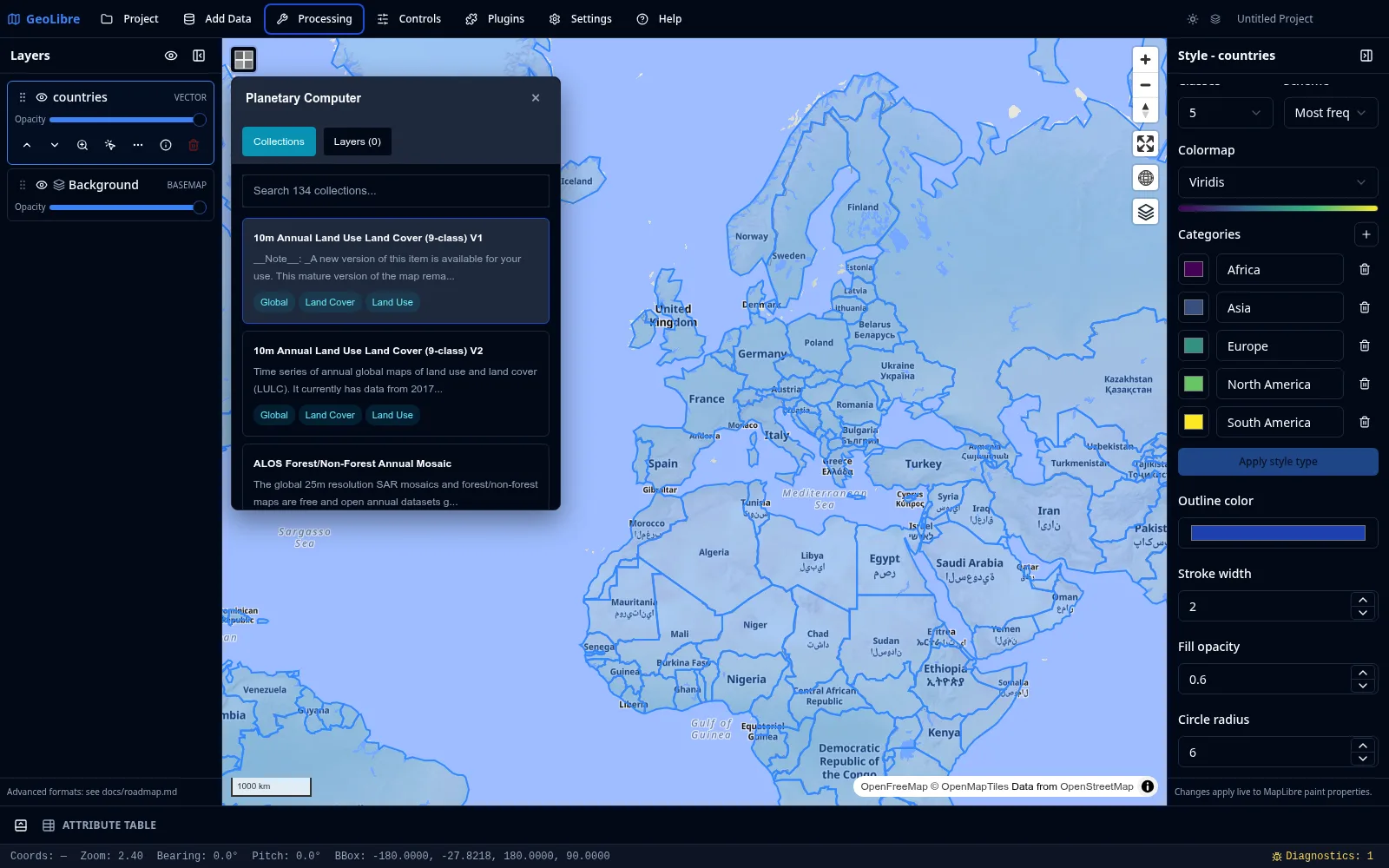
Cloud catalogs
| Integration | Where | What it does |
|---|---|---|
| Planetary Computer | Processing menu | Browse and load STAC data from Microsoft Planetary Computer (Sentinel, Landsat, and more). |
| Earth Engine | Processing menu | Browse and load Google Earth Engine datasets after authenticating. |
| Overture Maps | Plugins menu | Load Overture Maps data themes (such as buildings, places, and transportation). |
| STAC | Add Data menu | Search any STAC catalog and add matching raster items. See Adding Data. |
Credentials
Earth Engine requires authentication, and some providers expect an API key or token. Set these in Settings → Environment Variables. See Settings & Preferences.
Federal Web Services
The Web Services submenu of the Plugins menu bundles four United States federal data sources:
| Service | Data |
|---|---|
| FEMA | National Flood Hazard Layer (NFHL) flood data. |
| NASA Earthdata | NASA satellite and Earth science imagery. |
| EPA EnviroAtlas | Environmental and ecosystem data. |
| USGS | The National Map topographic and geographic layers. |
Imagery and street-level
| Integration | Where | What it does |
|---|---|---|
| Historical Imagery | Plugins menu | Browse historical Esri World Imagery snapshots. |
| Street View | Plugins menu | View Google Street View and Mapillary street-level imagery. Needs provider credentials (see Getting Started). |
Time series and comparison
| Plugin | What it does |
|---|---|
| Time Slider | Animate time series raster and vector data (COG, XYZ/WMTS, WMS-Time, and time-filtered GeoJSON) through a docked timeline. |
| Layer Swipe | Compare two layers side by side with a swipe handle. |
AI analysis
| Plugin | What it does |
|---|---|
| GeoAgent | AI-assisted geospatial analysis. |
All of these are activated from the Plugins menu, where you can also set their on-map position.
Geocoding
GeoLibre can turn addresses into points and points into addresses. Both run through a selectable provider; the public Nominatim service is the default and needs no key.
| Tool | Where | What it does |
|---|---|---|
| Geocode Addresses | Processing menu | Pick a CSV with an address column and geocode each row into a point layer. Each matched row keeps its original columns plus geocode_lat, geocode_lon, geocode_display_name, and geocode_importance (a match score). A per-run provider picker lets you switch backend for that batch. |
| Delimited Text Layer → Addresses | Add Data | Geocode a CSV/TSV at import time instead of a separate step: choose "Addresses" as the import mode, pick one or more columns to concatenate into the address (e.g. street, city, state), and each row is geocoded through the project's configured provider. Matched rows become points; rows with no match are kept (not dropped) with geocode_status: "unmatched" so they stay visible and fixable in the attribute table. |
| Reverse Geocode | Controls menu | A toggle. While on, click anywhere on the map to look up the address at that point, shown in a popup with a copy button. |
All three send coordinates or addresses to a third-party service, so the first time you enable Reverse Geocode (and whenever you run a batch, including at CSV import time) your data leaves your device for those requests. Reverse Geocode shows a one-time notice before it is first enabled.
Providers
Choose a backend in Settings → Geocoding. The selection, per-provider API keys, optional endpoint overrides, and contact email are saved with the project.
| Provider | API key | Notes |
|---|---|---|
| Nominatim (OpenStreetMap) | No | Default. Public endpoint is paced and row-capped (see below); point it at a self-hosted instance to relax both. |
| Pelias | Optional | Hosted geocode.earth needs a key; a self-hosted Pelias does not. |
| ArcGIS World Geocoder | Yes | Esri token / API key. |
| Mapbox | Yes | Mapbox access token (pk.…). |
| Yes | Google Maps Geocoding API key. Google does not officially allow browser cross-origin requests to this API, so a same-origin proxy may be required. |
API keys are stored in plain text in the .geolibre.json project file, so avoid sharing a project that carries them (the Project → Share flow can strip environment variables, but provider keys live under Geocoding settings).
Usage policy and limits
Requests to the public Nominatim endpoint are paced to one per second and a single batch run is capped at 1000 rows, in line with the Nominatim usage policy. Browsers cannot set a User-Agent, so the app identifies itself through the page Referer and the optional email parameter. Self-hosted Nominatim and the keyed providers (Mapbox, ArcGIS, Google, hosted Pelias) are not paced or capped by GeoLibre; their own quotas apply.
Configuring with environment variables
The Geocoding settings panel is the easiest way to configure a provider, but the same values can also be set as runtime environment variables (the same VITE_-prefixed mechanism used for imagery credentials). Explicit environment variables override the Settings panel.
| Variable | Default | Purpose |
|---|---|---|
VITE_GEOCODER_PROVIDER |
nominatim |
Provider id: nominatim, pelias, arcgis, mapbox, or google. |
VITE_GEOCODER_API_KEY |
unset | API key / access token for the selected provider. |
VITE_GEOCODER_ENDPOINT |
provider default | Forward (address to point) search endpoint override. |
VITE_GEOCODER_REVERSE_ENDPOINT |
provider default | Reverse (point to address) endpoint override. |
VITE_GEOCODER_EMAIL |
unset | Contact email sent as the email query parameter to identify your client to Nominatim. |